Geography of India
India Geography:
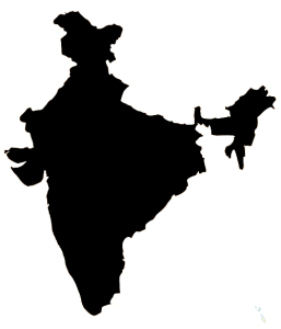
Location of India: Southern Asia, Arabian sea in the West and
the Bay of Bengal in the East, Between Burma
and Pakistan Area.
India Geography Area:
Total Occupation :
Land: 2,973,190 Sq.kms
Water: 314,400 Sq. Km
Comparative: more than one-third the size of the U.S.A
Land Boundaries:14,103 Km
Borders
Bangladesh: 4,053Kms
Chin: 3,380Kms
Pakistan: 2,912Kms
Nepa: 1690Kms
Burm: 1463Kms
Bhuta: 605
Time Zone :
Elevation Extremes
Lowest Point: Indian Ocean 0 M
Highest Point: Kanchanaganga 8598 Metres
Islands: Islands have covered a total of about 32 sq.Km
Andaman and Nicobar islands. Daman and Diu,
Majali, Salsethe, Sriharikota.
Resources: Mica, Bauxite, Manganese, Titanium Ore, Coal, iron
Ore, Chromite, Natural Gas, Diamonds, Petroleum,
Lime stone etc.
National Hazards: Earth Quakes, Environment, Flash Floods,
Draughts, Widespread destructive flooding from
Monsoon rains, Thunderstorms.
Peninsular Plateau: 1. The Deccan Plateau 2. The Malwa Plateau 3. The chota Nagour Plateau.
India Geography The Deccan Plateau: This is covered with 9 Million square kilometres and stretches to
eight states. This plateau was bounded by Vindhyas
and Eastern and Western Ghats.
The Malwa Plateau: This is spread to Gujarat, Rajasthan, is Madya Pradesh.
The Chota Nagpur Plateau: This Plateau is covered Jharkhand, Bihar and
Odisha and Chhattisgarh.
Coastal Plains: Eastern coastal Plains and Western coastal Plains.
Eastern Coastal Plains: These are spread from Tamil Nadu to West Bengal. The rivers which flew through the coastal plains are Godavari, Krishna, Kaveri and Mahanadi.
Western Coastal Plains: These are spread from Kerala to Gujarat. So many rivers flow through these plains.